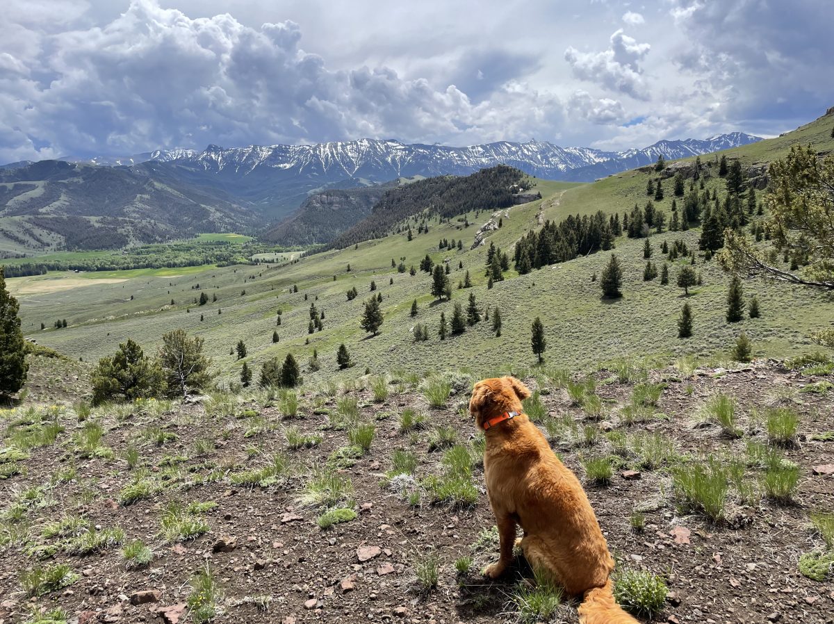
We are going to hike into that canyon in the photo below. From this photo you can see the mighty Clark’s Fork of the Yellowstone, the only wild and scenic river in Wyoming, un-runnable.
To the left you can make out Sunlight falls, where Sunlight creek meets the great river. What you can’t see is that just in front of the falls is Dead Indian creek running into the river as well, almost at the same spot but not as a falls.
Some day I’m going to take a raft down to the river and paddle upstream to that meeting place, but the Clark’s Fork needs to be slow and low.

There are a few trails down there from above, most fairly treacherous or extremely steep. The best runs near Dead Indian Creek from the road. There used to be signage with the mileage but someone took that down. Its four miles to the river, but its the last 3/4 mile that’s straight down.

Its an all day slog, and take water because there is none until you reach the canyon. Even though it wasn’t incredibly hot, the dog was panting heavily and needed the extra water I took for him.
That’s because its a fairly exposed hike. And plan to go in mid-August when the river is slower, take a lunch and chill…


The hike out is not welcome after the great rest at the river. Another alternative is to shuttle, leave a car at the mouth near Clark and hike down from the Sunlight Road. Someday I plan to hike an inflatable raft down there and spend a few days exploring upriver.

Hummmm “last 3/4 mile that’s straight down.” Let’s see going back that means the first 3/4 of a mile is straight up……..
LikeLike
I may be exaggerating just a tad! BUT you do descent approx. 1000 ft. in about 3/4 mile. There are crude switchbacks and you could walk a horse down (I wouldn’t ride but I’m fairly chicken); the grade is steep enough so that its slippery with all the shale. Definitely hard on the knees.
LikeLike
Did it when I was young. (78 now) Great view but dam hard. Do it when your young or don’t do it at all.
LikeLike
Trying to find out if anyone has ever hiked down to the base of Sunlight and/or Dead Indian Creek falls. Is this even possible? Looking at the topographical maps it looks like it would be difficult to hike back up the Clarks Fork from where this train ends up at the waters edge.
LikeLike
I understand that there is a way to get down from the top, but it is very treacherous. I myself am too scared of edges and heights to even explore or entertain the possibility. I think the way to do it would be this: sometime in mid- to late August, hike to the end of the canyon trail and bring an inflatable raft. You can actually take an ATV to the end of the road, but that’s really cheating and its only 4 miles. I have heard from old timers that from there you can go upstream, but there are several places where you have to cross in order to continue to the falls. Water levels are usually pretty low and slow in late August. From the ‘end of the road’ (the road actually continually up to the Switchback Ranch up switchbacks to the mesa), its probably no more than a mile upstream to the falls. Also, Dead Indian does NOT end in falls, but is low enough at that point to just enter the Clark’s Fork. Sunlight is the falls. You might want to ask around Cody for more info. I’m sure someone has done it.
LikeLike
Thanks Leslie. I might give it a try just as you suggest. Was out that way last May and hiked in to the point where you can see the Sunlight falls via the Dead Indian Campground train and tried to discover a trail down but couldn’t find anything my wife and I were comfortable trying. She also found a shedded bull elk antler and I spent the rest of the hike carrying this out for her.
LikeLike
for some reason keep typing train and not trail.
LikeLike
There is a good obvious trail just east of the campground. There used to be a signage but someone took it down. You’ll see a big pullout just before you begin to go up the road to your left. The trail is flat almost for 3 miles, then switchbacks 1000′ down to the river the last mile.
LikeLike
Leslie,
That is the trail we took, just not all the way to the water like you did. Quit well in advance of the switchback portion which takes you to the waters edge. Hoping we could find a side trail from the main trail that would take you to the base of the Sunlight falls. Will try and ask around this summer when am back out in the basin.
LikeLike
The ‘side trail’ that is treacherous comes down from the other side of the canyon. There is no side trail from the Clark’s Fork trail you took.
LikeLike
Leslie,
Are you talking about the Switchback ranch side of Clark’s Fork and if so does one hike up the canyon from beyond where the Jeep/ATV trail ends? From the topo maps it appears that there are portions of the canyon that become sheer cliffs on this side and wouldn’t afford the opportunity to hike all the way to the face of the Sunlight falls.
LikeLike
No. As said before, from that side you would have to take an inflatable raft and go upstream, crossing with the raft in various places. I am referring to coming down off the plateau and I am unclear exactly where that access is but I have talked with people who have done it and they say it is quite steep. I think you would approach it from the Sunlight Bridge and just walk all the way to the end. At that point there is a steep canyon which one can go down that takes you to the Clarks Fork and that would be between Dead Indian Ck and Sunlight Falls. Hard to explain but I think I know where that access is and its doable, not cliffy, but quite steep.
LikeLike